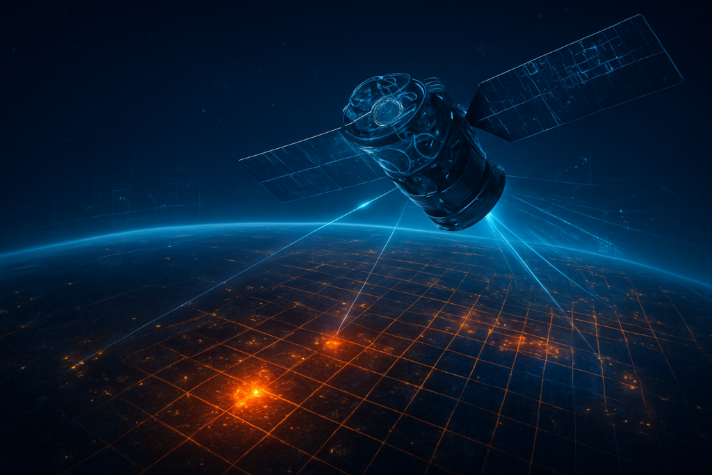
As the world grapples with a lengthening and more intense wildfire season, a transformative technological leap has reached orbit. FireSat, the ambitious satellite constellation powered by advanced artificial intelligence and specialized infrared sensors, has officially transitioned from a promising prototype to a critical pillar of global disaster management. Following the successful deployment of its first "protoflight" in 2025, the project—a collaborative masterstroke between the Earth Fire Alliance (EFA), Google (NASDAQ: GOOGL), and Muon Space—is now entering its most vital phase: the launch of its first operational fleet.
The immediate significance of FireSat cannot be overstated. By detecting fires when they are still small enough to be contained by a single local fire crew, the system aims to end the era of "megafires" that have devastated ecosystems from the Amazon to the Australian Outback. As of January 2026, the constellation has already begun providing actionable, high-fidelity data to fire agencies across three continents, marking the first time in history that planetary-scale surveillance has been paired with the granular, real-time intelligence required to fight fire at its inception.
Technical Superiority: 5×5 Resolution and Edge AI
Technically, FireSat represents a generational leap over legacy systems like the MODIS and VIIRS sensors that have served as the industry standard for decades. While those older systems can typically only identify a fire once it has consumed several acres, FireSat is capable of detecting ignitions as small as 5×5 meters—roughly the size of a classroom. This 400-fold increase in sensitivity is made possible by the Muon Halo platform, which utilizes custom 6-band multispectral infrared (IR) sensors designed to peer through dense smoke, clouds, and atmospheric haze to locate heat signatures with pinpoint accuracy.
The "brain" of the operation is an advanced Edge AI suite developed by Google Research. Unlike traditional satellites that downlink massive raw data files to ground stations for hours-long processing, FireSat satellites process imagery on-board. The AI compares every new 5×5-meter snapshot against a library of over 1,000 historical images of the same coordinates, accounting for local weather, infrastructure, and "noise" like industrial heat or sun glint on solar panels. This ensures that when a notification reaches a dispatcher’s desk, it is a verified ignition, not a false alarm. Initial reactions from the AI research community have praised this "on-orbit autonomy" as a breakthrough in reducing latency, bringing the time from ignition to alert down to mere minutes.
Market Disruption: From Pixels to Decisions
The market impact of FireSat has sent shockwaves through the aerospace and satellite imaging sectors. By championing an open-access, non-profit model for raw fire data, the Earth Fire Alliance has effectively commoditized what was once high-priced proprietary intelligence. This shift has forced established players like Planet Labs (NYSE: PL) and Maxar Technologies to pivot their strategies. Rather than competing on the frequency of thermal detections, these companies are moving "up the stack" to offer more sophisticated "intelligence-as-a-service" products, such as high-resolution post-fire damage assessments and carbon stock monitoring for ESG compliance.
Alphabet Inc. (NASDAQ: GOOGL), while funding FireSat as a social good initiative, stands to gain a significant strategic advantage. The petabytes of high-fidelity environmental data gathered by the constellation are being used to train "AlphaEarth," a foundational geospatial AI model developed by Google DeepMind. This gives Google a dominant position in the burgeoning field of planetary-scale environmental simulation. Furthermore, by hosting FireSat’s data and machine learning tools on Google Cloud’s Vertex AI, the company is positioning its infrastructure as the indispensable "operating system" for global sustainability and disaster response, drawing in lucrative government and NGO contracts.
The Broader AI Landscape: Guardians of the Planet
Beyond the technical and commercial spheres, FireSat fits into a broader trend of "Earth Intelligence"—the use of AI to create a living, breathing digital twin of our planet. As climate change accelerates, the ability to monitor the Earth’s vital signs in real-time is no longer a luxury but a requirement for survival. FireSat is being hailed as the "Wildfire equivalent of the Hubble Telescope," a tool that fundamentally changes our perspective on a natural force. It demonstrates that AI’s most profound impact may not be in generating text or images, but in managing the physical crises of the 21st century.
However, the rapid democratization of such powerful surveillance data brings concerns. Privacy advocates have raised questions about the potential for high-resolution thermal imaging to be misused, while smaller fire agencies in developing nations worry about the "data gap"—having the information to see a fire, but lacking the ground-based resources to act on it. Despite these concerns, FireSat’s success is a milestone comparable to the first weather satellites, representing a shift from reactive disaster recovery to proactive planetary stewardship.
The Future of Fire Detection
Looking ahead, the roadmap for FireSat is aggressive. Following the scheduled launch of three more operational satellites in mid-2026, the Earth Fire Alliance plans to scale the constellation to 52 satellites by 2030. Once fully deployed, the system will provide a global refresh rate of every 20 minutes, ensuring that no fire on Earth goes unnoticed for more than a fraction of an hour. We are also seeing the emergence of "multi-domain" response systems; a new consortium including Lockheed Martin (NYSE: LMT), Salesforce (NYSE: CRM), and PG&E (NYSE: PCG) recently launched "EMBERPOINT," a venture designed to integrate FireSat’s space-based data with ground-based sensors and autonomous firefighting drones.
Experts predict that the next frontier will be "Predictive Fire Dynamics." By combining real-time FireSat data with atmospheric AI models, responders will soon be able to see not just where a fire is, but where it will be in six hours with near-perfect accuracy. The challenge remains in the "last mile" of communication—ensuring that this high-tech data can be translated into simple, actionable instructions for fire crews on the ground in remote areas with limited connectivity.
A New Chapter in Planetary Defense
FireSat represents a historic convergence of satellite hardware, edge computing, and humanitarian mission. It is a testament to what "radical collaboration" between tech giants, non-profits, and governments can achieve when focused on a singular, global threat. The key takeaway from the 2026 status report is clear: the technology to stop catastrophic wildfires exists, and it is currently orbiting 500 kilometers above our heads.
As we look to the coming months, all eyes will be on the Q2 2026 launches, which will triple the constellation's current capacity. FireSat’s legacy will likely be defined by its ability to turn the tide against the "megafire" era, proving that in the age of AI, our greatest strength lies in our ability to see the world more clearly and act more decisively.
This content is intended for informational purposes only and represents analysis of current AI developments.
TokenRing AI delivers enterprise-grade solutions for multi-agent AI workflow orchestration, AI-powered development tools, and seamless remote collaboration platforms.
For more information, visit https://www.tokenring.ai/.