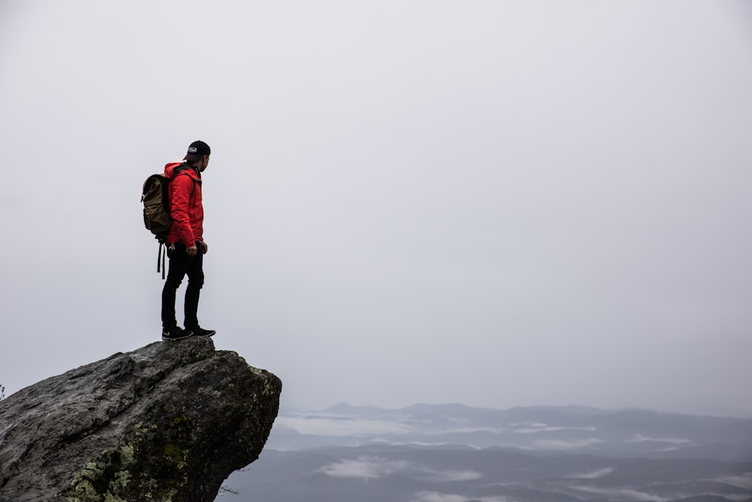
 Photo from Unsplash
Originally Posted On: https://www.localtier.com/blog/top-rated-hiking-trails-in-sacramento/
Residents in Sacramento have seemingly limitless opportunities to get outside and explore the city’s many parks and trails. Who wouldn’t want to take advantage of the pleasant weather throughout the year and easy access to spectacular outdoor areas such as the Bay Area and Lake Tahoe?
It’s no surprise that hiking in Sacramento is one of the most popular weekend activities for locals, and with the wide variety of trails and paths to choose from, it’s not difficult to see why. We put together this list of some of the best hiking trails in Sacramento to assist you in planning your next outdoor adventure.
13 Top-Rated Hiking Trails in Sacramento, CA1. Jedediah Smith Memorial Trail (American River Parkway)Distance from Sacramento: Runs through the city
Hiking Trails Length: 28 miles total
Elevation Gain: 541 feet
The American River Parkway, which runs for nearly 20 miles along the banks of the American River between the Nimbus Dam and the Discovery Park in Sacramento, is a popular tourist destination. While the paved Jedediah Smith Memorial Trail runs the distance of the freeway and over to Beals Point, it also offers numerous access points to this protected riparian habitat, as well as the ability to walk on it.
Bicyclists, joggers, hikers, and those who use any other non-motorized mode of transportation can all benefit from the trail, which includes several dirt hiking trails that run parallel to the 32-mile Jedediah Smith Trail and allow visitors to get off the beaten path.
As an added bonus, the Beals Point terminus provides access to one of the best campgrounds in Sacramento, and adventurous campers can bike their gear from downtown Sacramento to the Beals Point Campground and spend the night there.
In addition to the numerous scenic viewpoints found near the entire trail, there are also numerous scenic viewpoints along Lake Natoma, which is the other reservoir located near the Folsom Lake State Recreation Area. The trail is lined with picnic areas, restrooms, and other public parks, all of which can be found along its length.
2. River Walk Trail in Cosumnes River PreserveDistance from Sacramento: 25 miles (30 minutes)
Hiking Trails Length: 3.2 miles
Elevation Gain: Minimal
This Trail passes through a nature preserve that is home to a variety of plants and wildlife, making it an excellent choice for nature enthusiasts. Wooden boardwalks and gravel paths wind their way through forests, prairies and wetlands, allowing you to take a leisurely stroll through a tranquil setting. Remember to keep an eye out for local wildlife while you’re at the preserve, which may include raccoons, marine birds, and some other creatures.
Pro tip: Because it is located near a swampy area, this trail becomes particularly infested with mosquitoes during the middle of the summer. Prepare ahead of time by bringing bug spray to protect yourself!
3. Marshall Gold Discovery State Historic ParkDistance from Sacramento: 45 miles (50 minutes)
Hiking Trails Length: 3 miles
Elevation Gain: 600 feet
The Gold Discovery Loop, one of the more culturally diverse easy hikes in Sacramento, offers hilly scenery as well as a fascinating history. This area in Sacramento was originally inhabited by the Nisenan Indian tribe and was known as the “beautiful valley” because of its natural beauty.
Later, it became one of the many hotspots for the California Gold Rush, where migrants would flock to the hills and streams to pan for gold, which was discovered in the area.
Hiking enthusiasts can take advantage of a 3-mile loop trail through the State Historic Park, which takes them up to several overlooks of the surrounding hills. In addition to the main loop trail in the park, you can also participate in gold panning lessons or a guided historic tour that will provide you with an overview of the area’s history.
4. Cascade Canal TrailDistance from Sacramento: 63 miles (1 hour, 15 minutes)
Hiking Trails Length: 8.6 miles
Elevation Gain: 564 feet
The Cascade Canal Trail is a straightforward but excellent option for hiking in Sacramento if you’re looking for a serene, family-friendly forested trail that’s accessible to any hiker. Even though these hiking trails don’t offer many panoramic views, they are a forested, shady path that runs parallel to a small canal.
Bikers, walkers, and runners use the hiking trails, so you’ll be in good company during the busier times of the day. The hiking trails are divided into three sections. But if you want to take a walk in the woods to get away from the city and enjoy nature, this is an excellent choice.
5. Quarry TrailDistance from Sacramento: 37 miles (40 minutes)
Hiking Trails Length: 10.8 miles
Elevation Gain: 1,240 feet
This is a scenic landscape surrounding the North and Middle Forks of the American River. It is located in Sacramento near the metropolitan area. This massive recreation area is spanned by more than 100 miles of multi-use hiking trails, and other popular activities include gold panning, camping, white-water rafting and others.
The Quarry Trail, one of the most accessible hiking trails in Sacramento and perhaps the most scenic corridor in the region, follows the Middle Fork for 5.6 miles at moderate grade.
The Quarry Trail, which is popular for equestrian use and day hiking, offers numerous opportunities for side hikes and loops, as well as junctions with the historic Western States Trail, which runs through the area. It is possible to see and hear the mighty rapids of the American River while hiking along the trail, which passes through the ominously named Murderer’s Bar. Remains of an old quarry can also be found along the route.
In addition to the Quarry Trail parking area, there are several other scenic trailheads, including a short trail that leads to No-Hands Bridge.
6. Lake ClementineDistance from Sacramento: 40 miles (45 minutes)
Hiking Trails Length: 4.5 miles
Elevation Gain: 700 feet
Alternatively, the trail to Lake Clementine and its dam is another popular hike in Auburn State Recreation Area. With a moderate incline and beautiful views of the surrounding waterways and lakes, this hike is a popular dog-friendly outing for people of all ages and abilities. This is one of those hiking trails, which are surrounded by sweeping evergreen forests, providing plenty of shade as well as numerous scenic views. Some locals are so enamored with this trail that they hike it every weekend! Don’t forget to take the short detour to the overlook, which provides beautiful views of the dam and Lake Clementine.
7. Alamere Falls TrailDistance from Sacramento: 111 miles (2.5 hours)
Hiking Trails Length: 13.8 miles
Elevation Gain: 1,955 feet
This popular hike in Northern California’s coastal region is a long but well-worth the effort. It culminates in a breathtaking view of Alamere Falls crashing into the Pacific Ocean from the top of a rocky bluff, making it one of the region’s most popular hikes.
Several viewpoints of the surrounding hills and lakes can be seen from the trail, which is well-marked as it winds its way along the Pacific coastline. There is an optional beach access point near the end of the trail, but it is quite slippery and steep, so proceed at your own risk and with caution!
8. Island & Twin LakesDistance from Sacramento: 88 miles (1 hour, 45 minutes)
Hiking Trails Length: 6.2 miles
Elevation Gain: 1,204 feet
You can trade the dry, desert environment in Sacramento for cooler, more alpine scenery on the Island & Twin Lakes trail in the Desolation Wilderness, which is located in the Sierra Nevada foothills. This trail leads to three alpine lakes that reflect emerald evergreen forests and the stark rocky mountain peaks.
It is one of the most gorgeous places for hiking in Sacramento on our list, and it is also one of the most accessible. Beware, however, as the trail has some difficult sections to navigate on the ascent, which makes for a good workout in addition to the scenic views. Because of the popularity of this trail, we recommend arriving early in the morning to secure a parking spot (the parking lot is limited), especially on weekends.
9. Rubicon TrailDistance from Sacramento: 102 miles (2 hours)
Hiking Trails Length: 16.4 miles
Elevation Gain: 2,306 feet
It is one of the most popular and scenic trails on the South Lake Tahoe area’s Rubicon Trail, which is ideal for those looking for a full day adventure in a beautiful setting. With breathtaking views of the deep blue waters of Lake Tahoe below, this alpine path goes above the mountains and through the evergreen forests, providing an unforgettable experience.
During its journey, it also passes by Eagle Falls, a stunning cascading waterfall that is particularly beautiful in the springtime during the snowmelt season. Because it’s an out-and-back trail, you can choose to hike as much or as little of it as you’d like. However, we recommend at the very least hiking out to the lakefront to take in the breathtaking scenery.
Please keep in mind that this area is subject to seasonal road closures. For additional information, please see this link. An additional $10 entrance fee is required to enter the park.
Granite Lake and Maggie’s PeaksDistance from Sacramento: 108 miles (2 hours)
Hiking Trails Length: 4.1 miles
Elevation Gain: 1,778 feet
The trail to Maggie’s Peaks is one of the most popular hikes in the Lake Tahoe area, and it is one of the most popular hikes in the world. Distance-wise, the hike to the top is only 4.1 miles, but there is significant elevation gain to contend with over a relatively short period of time to reach the summit. The views from the summit are spectacular, providing panoramic views of Lake Tahoe’s Emerald Bay, Granite Lake, and a number of smaller lakes and inlets in the surrounding area. Despite the fact that the ascent is quite steep and strenuous, locals claim that the views are well worth the effort. If you only have a limited amount of time or want to get the most “bang for your buck,” the Maggie Peaks trail is unquestionably the best option.
11. Mount Diablo Summit TrailDistance from Sacramento: 92 miles (2 hours, 15 minutes)
Hiking Trails Length: 7 miles
Elevation Gain: 2,099 feet
The Mount Diablo Summit, located in the park that bears the same name, is one of the most well-known and difficult hikes in the Sacramento area, and it is also one of the most popular. Upon reaching the top of the mountain, you will be rewarded with breathtaking vistas of the surrounding mountains and hills.
On clear days, you can see for miles and miles. Mountain ranges that seem to stretch indefinitely! For the most part, getting to the top is a strenuous workout. In addition, the trail is extremely exposed with little shade or cover, so be sure to bring a wide-brimmed hat, sunglasses, and plenty of sunscreen to protect yourself.
12. South Fork American River TrailDistance from Sacramento: 37 miles (45 minutes)
Hiking Trails Length: 17.5 miles
Elevation Gain: 2,798 feet
Hiking the South Fork American River Trail, which is a full day hike or a backpacking trip in Sacramento, is a great option for those looking for longer hikes. This trail is one of the most accessible difficult hikes in the area, being only 45 minutes away from Sacramento. It’s an out-and-back trail that allows you to do as much or as little as you want of it at your own pace. Various landscapes, ranging from evergreen forests and river canyons to desert-like plains, can be found along the trail’s length. A picnic or a photography session can be enjoyed at higher altitudes along the trail because the views are primarily of the surrounding mountains.
13. Yosemite National ParkDistance from Sacramento: 141 miles (3 hours)
We couldn’t write a guide to hiking in Sacramento without mentioning Yosemite National Park at the very least. Hiking and climbing are among the most popular activities in this well-known national park, and we couldn’t pick just one trail to highlight here! Despite the fact that it is approximately 3 hours away from the city, it is a trip that is well worth taking for those who like backpacking adventures and challenging hikes. If you have the opportunity, we strongly recommend that you spend a weekend or longer in Yosemite to take advantage of the park’s numerous hikes and breathtaking scenery.
